|
by Blake Osborn - Southern Colorado Water Resources Specialist for the Colorado Water Institute and CSU Extension Think back to 3rd grade. Remember learning about the water cycle? It looked good on paper, didn’t it? Water moves through different environments (the soil, plants, atmosphere, streams) and it all ends up in the ocean. Well, in Colorado we’re a long way from an ocean. We are best characterized as a “headwaters” environment. With Mother Nature’s help, we are given a certain amount of water every year, a budget, if-you-will. It’s our job as water users and water stewards to make the best use of this water, all within the framework of our administrative king-pin called the Prior Appropriation Doctrine. 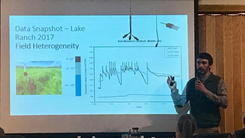 As scientists, we use a number of different tools and methods to estimate the amount of water in each of the different environments. How much water is in the soil? How much is left in the mountain snow fields? When will it melt, and what is the streamflow going to be? Further, these questions can be broken down into more nuanced questions like ‘how much water is within the plant’s rooting zone, and how much is below the root zone and “immune” to evaporation?’ If we are to make the best use of our water we need to know exactly where the water is located and how much is there.
As the largest water user in the state, agricultural water use is necessary to support one of our worst habits: eating. How nice would it be to not have to eat? Some would argue with that statement, as eating can be a great pleasure, but it also requires a lot of inputs like water and land. And that’s OK. It’s just the nature of growing food. Because agriculture uses a lot of water, it is often difficult to know exactly how much water is applied and how much is needed. It is entirely possible that we over irrigate our crops in certain times of the year, and under irrigate in other times. Almost all farmers do the best they can to make the best use of irrigation water, but the timing and amount of water available to them is very dynamic. This is a great challenge facing farmers around the world, but new tools are being developed to help make projections about the water demands of local crops that are cost-effective and easy to use. Currently, a research project between Colorado State University and the Upper Arkansas Water Conservancy District is trying to get a better grip on some of the questions from above. The movement of water between one environment and another, also called water fluxes, are being measured over a three year period to better understand how water availability, environmental conditions, and management decisions impact water use in agriculture. Instruments are set-up in four agricultural fields, from Buena Vista to Westcliffe, to measure things like precipitation, evaporation, and soil moisture changes. This important data can be used to more accurately estimate the amount of water agriculture is using in the region, inform water users where efficiencies might be possible through enhanced management, and help to develop irrigation scheduling tools to give farmers cost-effective and accurate data to make these decisions. Although we are in the middle of data collection and data processing, this research project has already uncovered some interesting results. First, if water is not a limiting factor and farmers are able to irrigate freely, they typically apply water in uniformity across the field. However, field and crop water demands can very highly variable within a field and applying water uniformly significantly impacts the efficiency of a system. This is called the “1 field, 1 number” concept. A farmer might irrigate their entire field based on the driest spot in the field, and if that spot needs 2.5 inches of water every week, then the entire field will get 2.5 inches of water every week, even if 75% of the field only needs 1.8 inches. This is entirely reasonable and a smart business decision on the part of the farmer. A big reason for this is that farmers are limited in their management decisions because irrigation technology is not flexible enough, or not cost effective, to apply water through precision agriculture. In short, understanding field conditions and how they impact the amount of water available to plants could be one of the biggest data gaps that is limiting the efficient application of water. Another interesting finding from this study is the significant impact “sub-irrigation” has on high-mountain flood irrigated hay fields, particularly in the Wet Mountain Valley. Sub-irrigation has long been known as an important factor for growing hay in this region, but the timing and duration of the sub-irrigation is significant, even during extreme drought years. Not surprisingly, fields located near streams are more susceptible to changes in sub-irrigation compared with fields not near streams. One field site, located within feet of Taylor Creek, showed greater decreases in sub-surface soil moisture compared with a field site located nearly a mile from a stream. This surface-groundwater connection is vitally important in most regions, but is especially true in flood irrigated regions like the Wet Mountain Valley. With 1 more year of data collection and data processing we are sure to uncover more information that can help to lead to more informed management decisions. It is much easier to manage something as important as water when we have a good understanding, and good data, to support our decision making. This partnership between the Upper Arkansas Water Conservancy District and Colorado State University is working to acquire this data, and use it to make better management decisions. The Arkansas River Basin is only given so much water each year, how we use and manage that water is critical to sustain healthy ecosystems, farming economies, and our cultural identities.
3 Comments
7/28/2022 12:52:29 pm
A research project between Colorado State University and the Upper Arkansas Water Conservancy District is trying to get a better grip on some of the questions from above. The movement of water between one environment and another, Thank you for sharing your great post! Leave a Reply. |
ABOUTLocal water news by the Upper Arkansas Water Conservancy District Archives
August 2023
Categories |
Menu
 RSS Feed
CONNECT |
|
UAWCD Technology Accessibility Statement
UAWCD is committed to providing equitable access to our services to all Coloradans.
Our ongoing accessibility effort works towards being in line with the Web Content Accessibility Guidelines (WCAG) version 2.1, level AA criteria. These guidelines not only help make technology accessible to users with sensory, cognitive and mobility disabilities, but ultimately to all users, regardless of ability.
Our efforts are just part of a meaningful change in making all State of Colorado and local government services inclusive and accessible. We welcome comments on how to improve our technology’s accessibility for users with disabilities and for requests for accommodations to any UAWCD services.
Requests for accommodations and feedback
We welcome your requests for accommodations and feedback about the accessibility of UAWCD’s online services. Please let us know if you encounter accessibility barriers. UAWCD is committed to responding as quickly as possible.
E-mail: [email protected]
Mail: P.O. Box 1090, Salida, CO 81201
Phone: 719-539-5425 (Written requests are preferred. If you are unable to submit your request in writing, you are welcome to contact us by telephone at this number.)