|
This time of year, Colorado’s water leaders meet in Denver at the annual Colorado Water Congress convention. Water managers, attorneys, engineers, board members of the State’s water conservation and conservancy districts, and State water officials convene around an agenda that includes the latest conversation on current water issues, projects, new concepts to optimize water use and legislative initiatives. How the new State administration may deal with the water plan will be on everyone’s mind. New concepts of water appropriation and administration will be discussed with pro and con debate. These concepts will continue to revolve around alternative transfer methods and the perennial discussion over drought and the prospect of drought. The culture of water use and drought are intermingled in the spirit of the West. The aridity of the Western USA is a constant condition in the thoughts of water users. I believe it is appropriate for our readers to ponder the following poem written over 70 years ago by arguably the greatest American poet, Robert Frost. Robert Frost was a farmer and he understood the dependence upon vagaries of weather that agriculturalists face. THE BROKEN DROUGHT
By: Robert Frost The prophet of disaster ceased to shout. Something was going right outside the hall. A rain, though stingy, had begun to fall That rather hurt his theory of the drought And all the great convention was about. A cheer went up that shook the mottoed wall. He did as Shakespeare says, you may recall, Good orators will do when they are out. Yet in his heart he was unshaken sure The drought was one no spit of rain could cure. It was the drought of deserts. Earth would soon Be uninhabitable as the moon. What for that matter had it ever been? Who advised man to come and live therein?
1 Comment
A veteran of the Civil War, John Wesley Powell, began the exploration of the arid west in 1869 to analyze its unique characteristics. At the time the Western United States was comprised of a group of territories in a landscape much of which was devoid of the lush vegetation characteristic of the Eastern part of the North American continent. This land—the Great American Desert—created developmental challenges for the US Government. Unlike the East and Mid-West water was scarce and an intricate system of water diversions and distribution canals was necessary to develop these territories into productive regions. Yet in 1890 a report from Powell to the Senate Select Committee on Irrigation and Reclamation of Arid Lands fell on deaf ears. Based upon Powell’s accumulation of data and findings from earlier western lands explorations he recommended the development of political jurisdictions based on hydrologic divides or watersheds. He was ignored, and states were created along arbitrary boundaries devoid of any natural physical land characteristic. It would take nearly 50 years before Powell’s recommendations would be instituted, but not from the Federal Government. 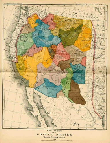 Powell’s map on the left depicted with jurisdictions bounded by natural hydrologic features. Water drainages would have political jurisdictions distinctly divided by natural water courses and their corresponding water sources. Colorado, a headwaters state which sends water to all the arid regions of the west, was the first to develop legislation authorizing the creation of political subdivisions designed to have jurisdiction over watershed regions. Powell’s recommendation would take root within a state under the legislative authority of the Water Conservancy Act. The Upper Arkansas Water Conservancy District is one of these entities.
The Water Conservancy Act was adopted by Colorado in 1935. It charges these water districts with the responsibility to do “Works” as defined in the statute. These Works are the development of water and power resources both physical and intangible. Some of the physical structures are reservoirs and water diversions to supply water for irrigation, municipal, industrial and other uses within its jurisdiction. Intangible assets may be accumulated data on weather and stream flows, acquisition of decrees for water rights, or the creation of augmentation plans that cover large portions of a watershed. Other political subdivisions, such as counties do not have the jurisdictional authority to conduct water activities, and because their boundaries are arbitrary and do not necessarily follow hydrologic divides, which are essential to the accomplishment of major water works. Since revenues obtained by political subdivisions must be utilized for the benefit of the citizens within that division, these revenues cannot be used to benefit a part of a watershed outside the political subdivision. Likewise, the authority to direct the use of these revenues outside a political subdivision is lacking. For example, funds spent on a project inside a county generated from a levy upon the citizens of that county cannot be utilized to benefit the watershed outside of that county. Powell recognized this reality although on a larger scale. Water Conservancy Districts undertake watershed-wide projects authorized through the Water Conservancy Act. One of the present conundrums being discussed by some entities is how to undertake basin-wide projects—such as forest health and stream management projects. The clear answer lies in the Water Conservancy Act. It is through Water Conservancy Districts with basin-wide jurisdiction that these projects can be undertaken. Some recent articles have been written about large scale projects of the Upper Arkansas Water Conservancy District that create benefits for large portions of the Upper Arkansas watershed. The District has the jurisdictional authority to utilize revenue from various sources including its own revenue sources and match the revenue source commensurate with a localized benefit. On a smaller scale the District has undertaken integrated water management projects with municipalities on tributary drainages such as the South Arkansas River. On a larger scale the District’s Umbrella Augmentation Plan crosses several counties, all within the same watershed. The District can combine cost share funds from several political subdivisions with state and federal grants. Other entities lack these abilities either because they lack specific legal authority or are unable to expend funds for benefits outside their jurisdictions. As the population of the Arkansas Basin increases the challenges of providing adequate clean water supplies will increase. It is comforting to know and understand that these challenges can be met by good planning and actions of our Water Conservancy Districts. In the Upper Arkansas watershed that entity is the Upper Arkansas Water Conservancy District. You can learn more about our projects at www.uawcd.com or by contacting the District and finding out about our Water Talks education program. Upper Arkansas Water Conservancy District Responds to Hayden Fire & Flood Recovery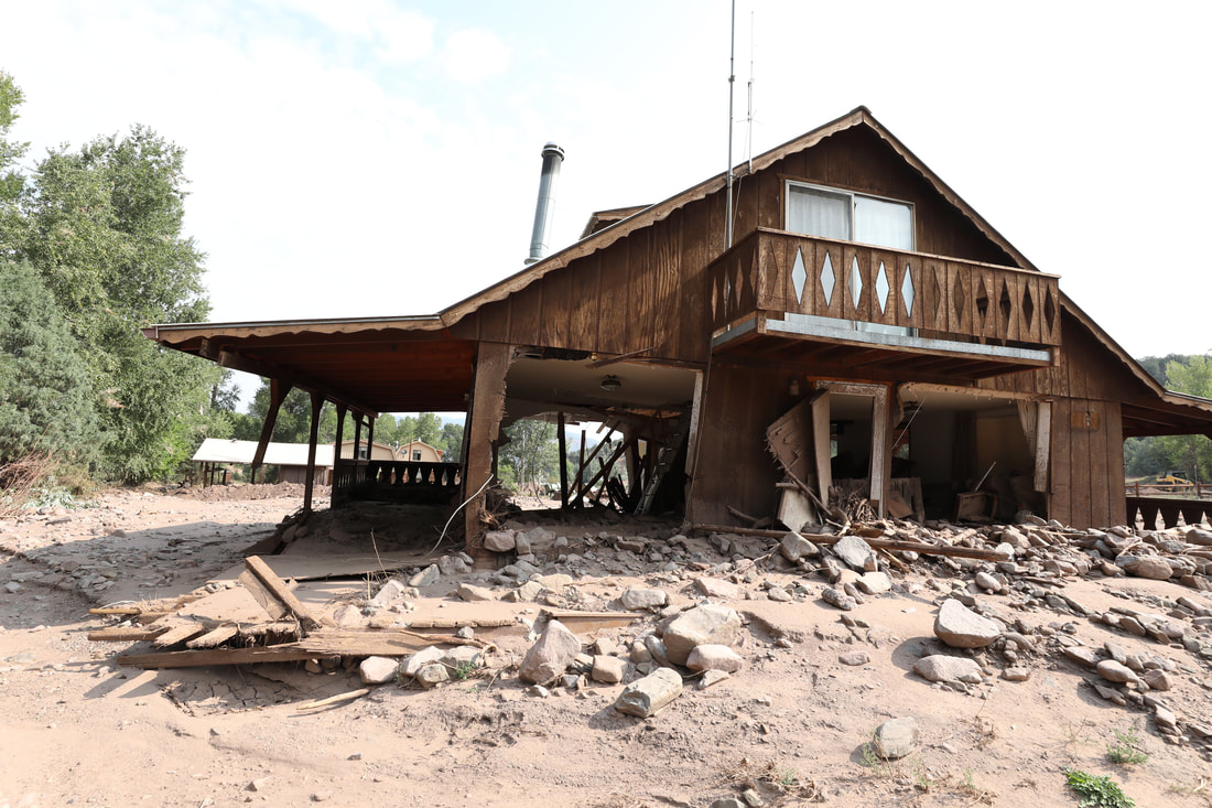 Home damaged during the July 2018 flood. Picture courtesy of Kate Spinelli Photography In July 2016, a lightning strike ignited a fire that would burn over 16,000 acres of forest above the community of Coaldale in western Fremont County. Homes, businesses, critical transportation infrastructure, habitats to threatened species, and recreational areas were all located in and around the burned areas. Following the fire, monsoon rains arrived in early August, bringing the first of many flash floods and debris flows. The extreme weather events and flash floods continued in 2017 and 2018, with the worst damage to date occurring on July 24, 2018. That day due to the intensity of the rainfall, the Big Cottonwood Creek experienced an estimated flow rate of approximately 4,000 cubic feet per second (cfs) which caused the loss of homes, outbuildings, vehicles, and bridges, and required a helicopter rescue. Flooding continued throughout the summer and early fall as well. 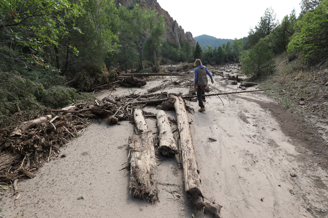 Picture courtesy of Kate Spinelli Photography Since that time, the Upper Arkansas Water Conservancy District has responded and began assisting with flood recovery efforts. Our focus has been to secure critical funding to complement the work of Fremont County and the Emergency Watershed Protection grant they have received from the Natural Resource Conservation Services (NRCS) which is earmarked at protecting private property along the Big Cottonwood. Working in partnership with the Arkansas River Watershed Collaborative (ARWC), we received a grant from the Colorado Water Conservation Board that will fund a fire recovery coordinator, hydrologist, and engineer whose primary function is to coordinate fire and flood recovery efforts in the area. This team will work with stakeholders, landowners, and various residents to develop a comprehensive and inclusive drainage recovery plan along the Big Cottonwood for the long-term sustainability and safety of the area. 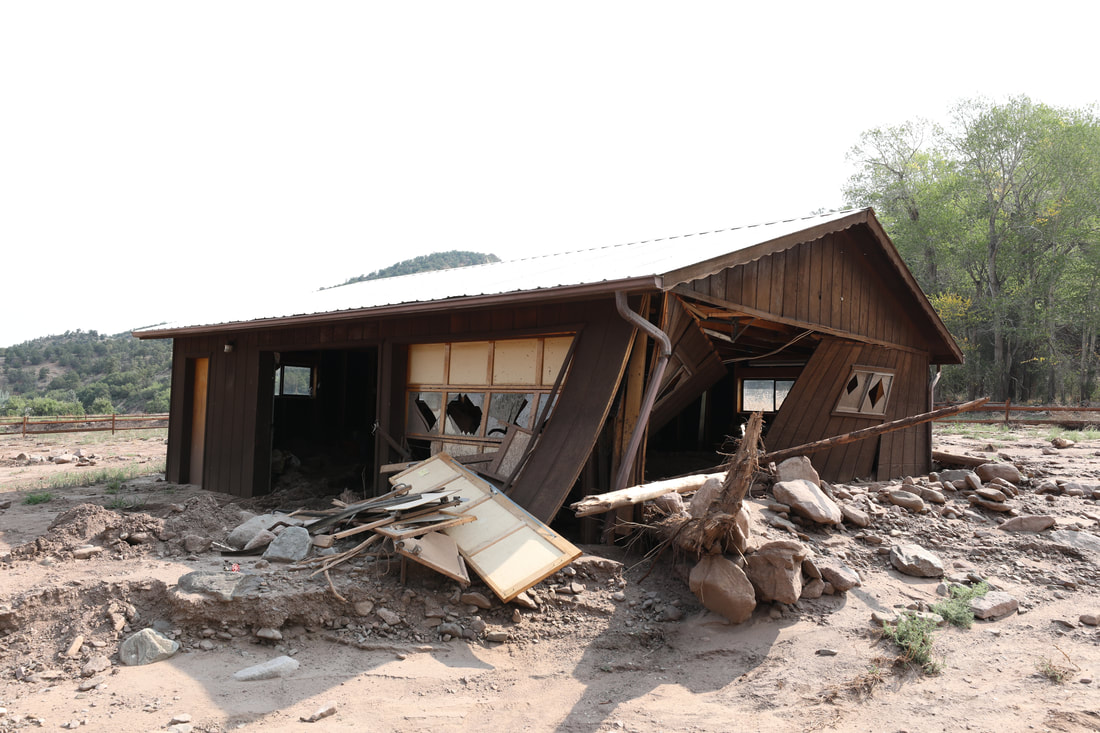 Outbuilding damage from July 2018 flood. Picture courtesy of Kate Spinelli Photography We have recently applied for a second grant for the Hayden Pass fire and flood recovery efforts to develop a Watershed Recovery Coalition that will include not only the Big Cottonwood drainage, but will expand to include all areas affected by the Hayden Pass fire. The work will expand the engineering analysis and risk assessment of all of the drainages affected by the fire and will ultimately result in the development of a master drainage recovery plan. We are hopeful that the grant will be awarded and we can continue supporting the Coaldale community. 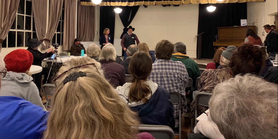 Fremont County Commissioner Dwayne McFall and County Manager Sunny Bryant speak to Coaldale residents about the EWP grant the County received from NRCS for recovery efforts during a community meeting in November 2018. Being proactive with the health of our local forests is essential. Not only does it protect people, wildlife, the surrounding communities and infrastructure, but it also protects important water resources. The Upper Arkansas Water Conservancy District is also working on other initiatives, including the Monarch Pass Forest & Watershed Health project helping to bring the necessary funding to this important project.
To learn more about the UAWCD and our other forest and watershed health projects, please contact Projects Manager, Chelsey Nutter. About Water Talks Water Talks is a monthly column published in area newspapers by the Upper Arkansas Water Conservancy District. Entering its 25th year as one of the leading water events in Colorado, the Arkansas River Basin Water Forum is set for April 24 – 25, 2019 at the Pueblo Convention Center. 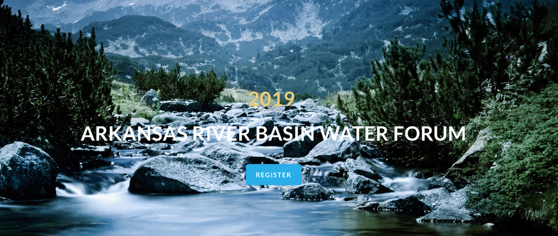 Beginning in 1995 in Pueblo, the Arkansas River Basin Water Forum was developed as a means to bring together the diverse water interests throughout the Basin and the state of Colorado to explain their views and engage in open dialogue about water issues in the Arkansas River Basin. Through this dialogue, each year the Water Forum seeks to create a greater understanding of Colorado water law, water use, and water conservation through a 2-day event complete with educational sessions, keynote speakers, presentations, scholarship program, special awards and more. The Upper Arkansas Water Conservancy District board and staff has been involved with the Forum since the inception and continues to sit on the planning committee. UAWCD Consultant Ken Baker was the 2018 recipient of the Bob Appel award as well.
In 2019, the Water Forum is celebrating its 25th anniversary, returning to Pueblo to commemorate this incredible milestone. Not many events last 25-years which attests to the outstanding quality and commitment to the annual Water Forum which welcomes over 200 people every year representing agricultural, municipal, industrial, environmental, recreational, and governmental interests. The annual Water Forum generally alternates its location between the upper and lower basins, supported each year by an outstanding planning committee comprised of dedicated people who come together to sponsor and host the Arkansas River Basin Water Forum. In 2020 the Water Forum will return to Salida. Over the years, through the annual Water Forums, a wider understanding of water issues has evolved and along with it the opportunity to find common ground. We invite you to get involved and to join the Arkansas River Basin Water Forum and the Upper Arkansas Water Conservancy District on April 24-25, 2019 in Pueblo at the Pueblo Convention Center. To learn more, visit: www.arbwf.org While performing regular water management operations, the Upper Arkansas Water Conservancy District encountered a significant issue with Colorado Water Conservation Board staff. The issue came to light when hydrologist Jord Gertson presented his water storage report during the district’s November meeting.  Photo courtesy of Joe Stone, Ark Valley Voice Gertson said he received a “verbal okay” from Water Commissioner Brian Sutton to exchange water up to North Fork Reservoir, but the next day Sutton informed him that the CWCB had “called” for water to meet its in-stream flow water right on North Fork Creek.
In 2017, the Upper Arkansas Water Conservancy District developed a comprehensive education plan to help us expand our outreach and education efforts. We, as your local water district, want to better engage the public through well-informed discourse regarding local water management and to offer educational programming and resources in the Upper Arkansas Basin. The Upper Arkansas Water Conservancy District has served your communities for over 40 years andwe would like the opportunity to share with you what we have learned. We believe that education is the key to building successful projects for the future to effectively and efficiently manage our most precious resource - water.  In the last year, following the development of our education plan, the Upper Arkansas Water Conservancy District has built various education programs to assist in the education on water-relatedtopics in the community. We now offer a monthly educational column in regional newspapers. It is there that we talk about new projects, essentialfunding sources, and potential solutions to our water challenges. We’ve also created educational literature available at our office for pick-up and hosted water education events throughout the area including documentaries and our annual Water Fest, a family-friendly water education event in Buena Vista and Salida.
Most recently, we have launched a new educational website full of information. We provide many resources on the site including a water resource data section where visitors may view information related to stream discharge, reservoir contents, water temperature, and weather conditions. We also have a comprehensive listing of links and resources, a blog where we will continue to feature news related to local water issues, and information regarding water administration and storage projects. You may view our new website at www.uawcd.com In 2019, the Upper Arkansas Water Conservancy District will continue to build upon our water education programs and opportunities. An understanding of water history, law, and administration are essential to developing solutions to our future water challenges. We strive to provide the groundwork for this type of water education, in turn, building a more informed community. If you have any questions or if there is something, you’d like to learn more about, please contact Chelsey at 719.539.5425 and let us know. We’d enjoy hearing from you. Recently, the Colorado Water Conservation Board awarded the Arkansas River Watershed Collaborative and the Upper Arkansas Water Conservancy District $403,739 to move the Monarch Pass Watershed and Forest health project along. 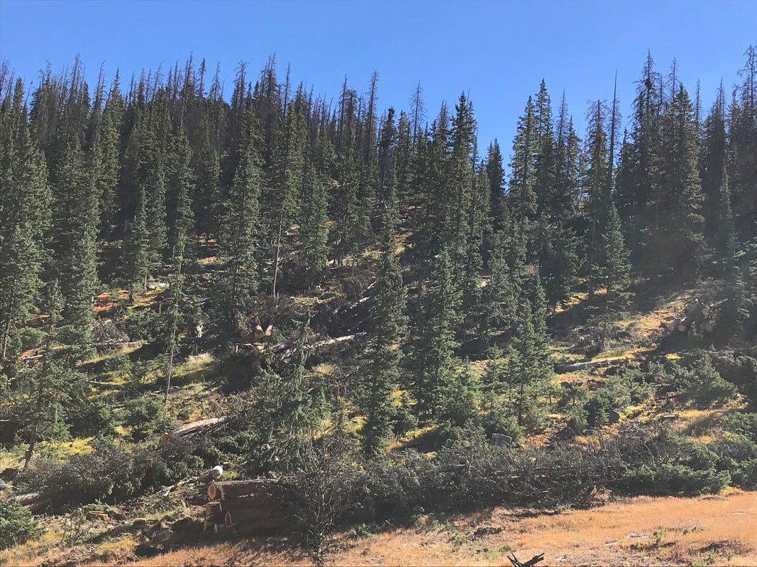 The US Forest Service is working on a fuels mitigation project to treat approximately 3,000-acres of beetle-kill by harvesting the dead trees. The UAWCD has joined these efforts to help secure funding and partners for approximately 600-acres of the project. This phase of the project will utilize new and innovative technology that will allow access on the steep slope terrain east of Hwy 50. You can read more about the project here.
The Colorado Water Conservation Board stated that this is the first watershed and forest health project of its kind in the state of Colorado and sees it as a leader which will demonstrate future funding requirements for these types of projects. Current Monarch Pass project financial partners and contributions to date:
Collectively, these financial contributions bring the local and state match to just over $660,000. An outstanding showing of how diverse interests can work together for watershed and forest health. Thank you to everyone who has provided support to date. If you're interested in learning more, please contact Chelsey Nutter, Projects Manager. A statewide funding source for local needsAre you aware that Colorado has a Water Plan?
Issued by Governor Hickenlooper in 2014, the Colorado Water Plan was created as a roadmap to address Colorado’s current and future water needs, including those in our community. The Water Plan was led by the Colorado Water Conservation Board and was a multi-year collaborative process rooted in extensive engineering analysis, local and statewide stakeholder input, and identified what our water needs are and how to overcome those challenges. Now that this inclusive plan has been created and put into action, the question remains: How does Colorado continue to fund its implementation and close the $100 million gap created by the reduced severance tax funding on an annual basis? Currently, the Inter-basin Compact Committee, a committee arising out of the “Colorado Water for the 21st Century Act” legislation to facilitate conversations on the statewide level between the nine Basin Roundtables, is working in partnership with the Colorado Cattleman’s Association and two predominate foundations to develop a new framework geared toward funding Colorado’s water future. This leadership team comprised of local and statewide water managers, officials and experts, including the Upper Arkansas Water Conservancy District, has identified healthy rivers, water quality, conservation and efficiency, sustainable agriculture, infrastructure, and Colorado compacts, as the six primary categories for the fund. There are common themes throughout these water priority areas with one being the need to improve forest health. As you know, by protecting forest health we do many things, including protect rivers and streams from sedimentation - a leading cause to the degradation of our water supply and quality. And with most of our water supply situated within national forest lands, protection and improvement of the forest is paramount to our water future. The Upper Arkansas Water Conservancy District has utilized and leveraged state funding over the years to actively address water challenges in our community and basin. Our forest and watershed health project on Monarch Pass is a great example of how statewide funds benefit all of us here. This new source of statewide funding would be under the jurisdiction of the State of Colorado and would provide the necessary financial resources to face our future water challenges, together. It would have a broad and lasting impact on important needs in our own community and would disperse the responsibility of funding across the State. The Upper Arkansas Water Conservancy District supports funding of this effort based upon a statewide approach. It looks forward to continuing its works and being a part of creating a clear path forward to funding important water and forest health projects on the state, basin, and District-wide levels. Join the Upper Arkansas Water Conservancy District for a two-day water festival. 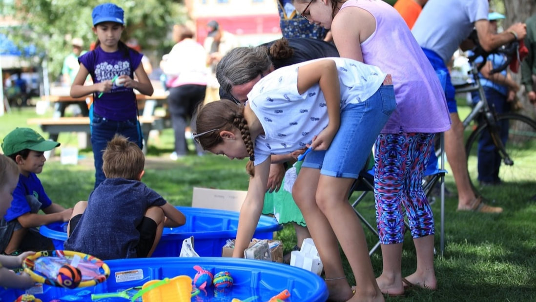 This great family-friendly (and fun!) water education event is sponsored by the Upper Arkansas Water Conservancy District, in partnership with the Foodshed Alliance and are held in conjunction with the Salida Farmers Market and the Buena Vista Farmers Market. Enjoy water education for children and adults as well as demonstration and exhibits.
Free and open to the public. --Saturday, August 25th - Salida @ the Farmers Market, Alpine Park --Sunday, August 26th - Buena Vista @ the Farmers Market, South Main Square Water Talks: Protecting Our Water Resources -Monarch Pass Forest and Watershed Health Project8/6/2018 No doubt fire is on everyone's minds this summer. It is clear that being proactive with the health of our local forests is imminent. Not only does it protect people, wildlife, the surrounding communities and infrastructure, but it also protects important water resources. 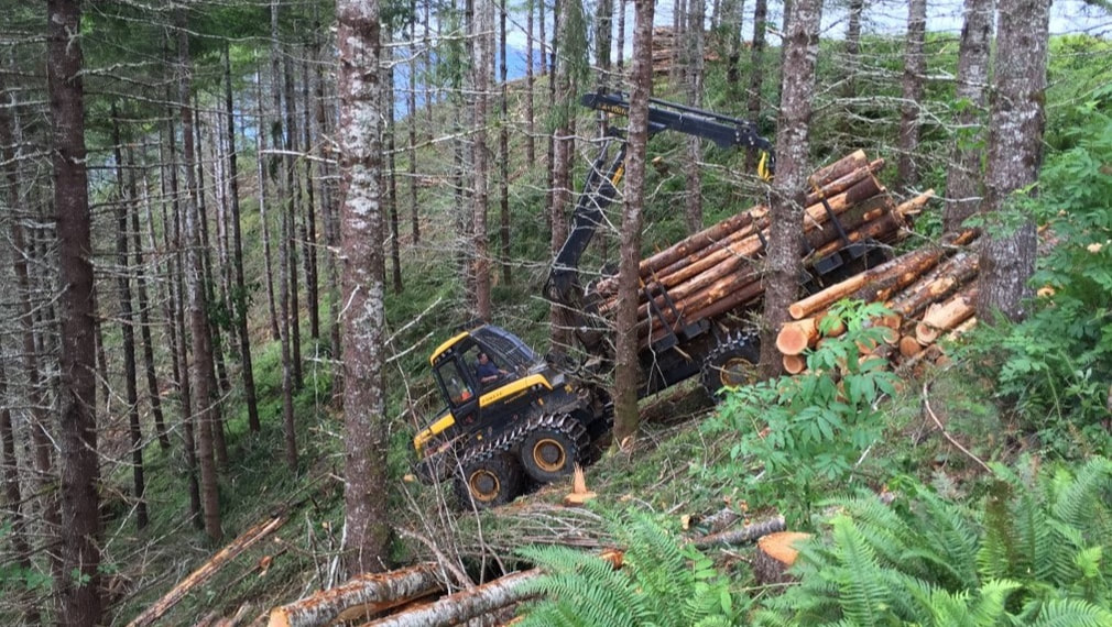 The flash flooding and resultant runoff full of sediment, rocks, and debris that occurs with every big rain event following a wildfire, impacts the tributary streams, creeks and ultimately the Arkansas River. Forest fires also threaten storage vessels which provide critical water supply to all water uses; agricultural, municipal, environmental and recreational. Here at the Upper Arkansas Water Conservancy District we're working on an innovative forest and watershed health project on Monarch Pass to address wildfire before it happens. A proactive approach to watershed health The spruce beetle activity across the Monarch Pass area has increased to endemic levels, deteriorating the forest at an alarming rate. The US Forest Service (USFS) is moving forward with a fuels mitigation project that will treat approximately 3,000-acres of beetle-kill on Monarch Pass by harvesting the dead trees. The UAWCD has joined these efforts to help secure funding and partners for approximately 600-acres that is on steep slope terrain. Generally, steep slopes are excluded from forest mitigation projects due to safety concerns and the high costs associated with using traditional methods to remove down and dead trees. Yet, treating steep slopes is imperative. Often our most critical water supplies such as reservoirs and important drainages that feed into the Arkansas River are surrounded by steep slopes. Initial research has identified over 20,000 acres of this type terrain in the mountainous areas of the Arkansas drainage. Fortunately, the USFS has identified a new technology that can treat the steep slopes on Monarch Pass while at the same time saving money, reducing the impact to the environment and improving safety. This cutting-edge technology has never been used in Colorado, and when successful, this project will very likely become a statewide model for treating steep slopes across Colorado and hopefully encourage investment from private industry. 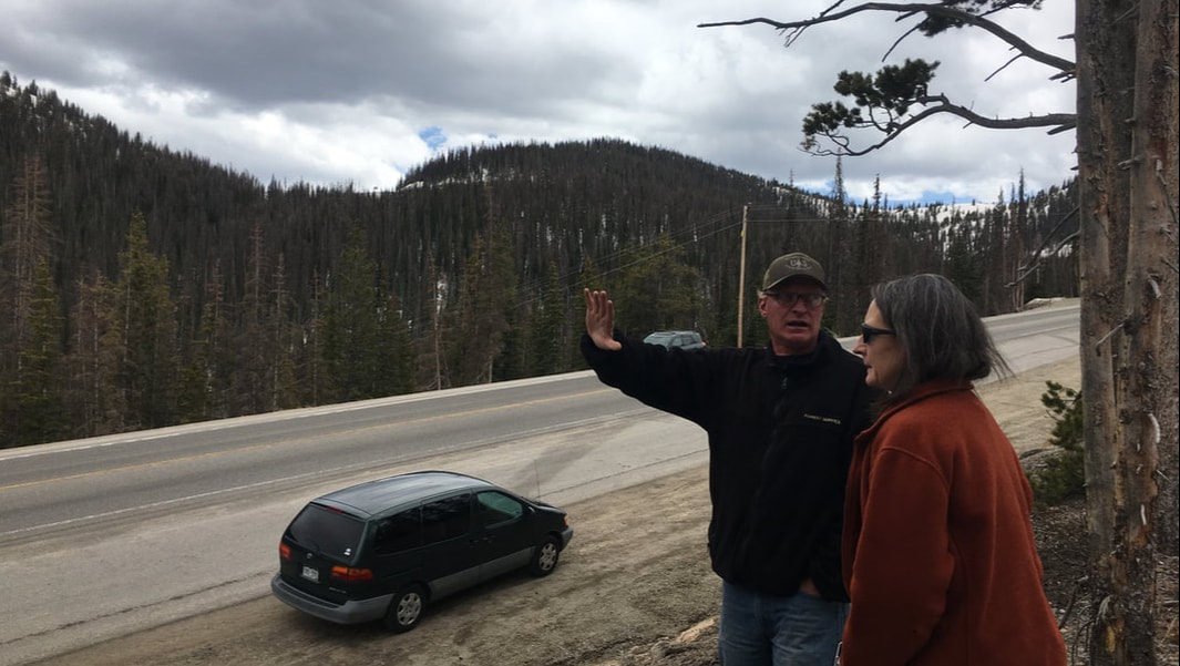 The UAWCD is taking the lead and a very active role with outreach for the project to bring more partners and money to the table to protect our local water supply, as well as to introduce this new technology to others in the state. We recognize the urgency of protecting our forest and water resources and non-federal matching dollars help expedite the process significantly. We’re excited that to date, the UAWCD in partnership with Chaffee County, City of Salida, Town of Poncha Springs, Colorado Springs Utilities, and the Arkansas River Watershed Collaborative, have secured the needed matching funds to apply for a Colorado Water Conservation Board grant that could provide over a half million dollars for the project. The UAWCD is continuing to look for additional funding partners throughout the State and water community to move this project toward implementation and before a catastrophic forest fire. We encourage the water community, local municipalities, and other entities to support this project and to make it a priority. Although matching dollars are the best resource to move this project forward, Letters of Support are also vital and demonstrate that our community is committed to a hands-on approach to addressing forest and watershed health concerns. A special thank you to Central Colorado Conservancy for being the first local non-profit to provide a Letter of Support and volunteer hours for this project. It is not a matter of ifour local forests and water supply will be impacted by wildfire, but rather a matter of when. Let’s be proactive, today. 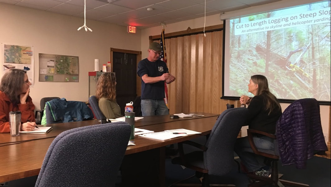 Naturally what is emerging out of this project is a grassroots local watershed entity - a group of local and statewide partners working together on an important forest and watershed project. We hope to continue to build upon the momentum and strength of this effort for future projects. For more information, please contact Chelsey Nutter at UAWCD. About Water Talks
Water Talks is a monthly column published in area newspapers by the Upper Arkansas Water Conservancy District. |
ABOUTLocal water news by the Upper Arkansas Water Conservancy District Archives
August 2023
Categories |
Menu
 RSS Feed
CONNECT |
|
UAWCD Technology Accessibility Statement
UAWCD is committed to providing equitable access to our services to all Coloradans.
Our ongoing accessibility effort works towards being in line with the Web Content Accessibility Guidelines (WCAG) version 2.1, level AA criteria. These guidelines not only help make technology accessible to users with sensory, cognitive and mobility disabilities, but ultimately to all users, regardless of ability.
Our efforts are just part of a meaningful change in making all State of Colorado and local government services inclusive and accessible. We welcome comments on how to improve our technology’s accessibility for users with disabilities and for requests for accommodations to any UAWCD services.
Requests for accommodations and feedback
We welcome your requests for accommodations and feedback about the accessibility of UAWCD’s online services. Please let us know if you encounter accessibility barriers. UAWCD is committed to responding as quickly as possible.
E-mail: [email protected]
Mail: P.O. Box 1090, Salida, CO 81201
Phone: 719-539-5425 (Written requests are preferred. If you are unable to submit your request in writing, you are welcome to contact us by telephone at this number.)